HOW IT WORKS

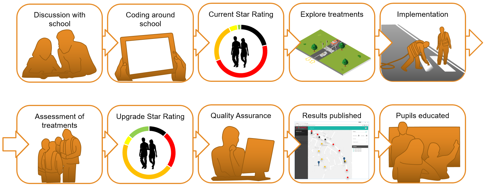
We know the road features that affect the pedestrian safety on a journey to school. Using evidence-based research of their impact on safety, a Star Rating is calculated at spot locations, where 1-star is the least safe and 5-star is the safest. SR4S combines a central web application and a data collection Android app that harness the power of the iRAP Star Rating for Pedestrians.

Once the risk is measured, effective scenarios of road treatments and their impact on safety can be simulated to identify cost-effective solutions. The implementation of the treatments can ultimately be tracked so that the partner and funder can see the benefits of their investment and the school teaching staff can educate the pupils on the correct use of the treatments.

WHAT ROAD FEATURES ARE RECORDED?

Download the Star Rating coding guide to understand what needs to be recorded

Step by step process

STEP 1: PARTNERS FOR SUCCESS
Effective road safety interventions involve a number of stakeholders working collaboratively and positively together. Stakeholders can be important allies when it comes to communicating the vision, objectives and results of a project to a wider audience. If an important stakeholder is not engaged throughout the process, they are more likely to prove obstructive to it.

The major stakeholders may include:

  • The local community
  • Governmental authorities (both local and national)
  • Road authorities
  • Private organisations
  • Health agencies
  • Educational agencies
  • Council administrations
  • Local civil society organisations.


STEP 2: SECURE FUNDING
Adequate funding needs to be secured for every aspect of the planned project. The costs that must be covered include:

  • Working hours of the team directly involved in carrying out the project
  • Training activities undertaken by the team
  • Production of communication materials
  • Supporting outreach activities like engagement meetings and surveys
  • Implementing findings such as road upgrades
  • Mass media campaigns.
STEP 3: BUILD CAPACITY ON ASSESSMENTS

Build and develop assessment teams and make the most of their skills when it comes to infrastructure data collection. Project partners responsible for Star Rating for Schools data collection are required to attend formal training delivered by the International Road Assessment Programme (iRAP) or a SR4S Lead PartnerYou can register here to attend SR4S video courses (in English or Spanish). 

STEP 4: IDENTIFY HIGH-RISK SCHOOLS
Select the schools that will be assessed. It is important to prioritise high-risk locations, but it is also clever to align the school zone assessment plans with the strategy from road authorities and municipalities. Check for any data or preliminary risk studies that may have already been conducted by relevant parties, such as crash data, a Pedestrian Plan that highlights areas for improvement, or an existing school zones programme with priority school areas already mapped.
STEP 5: ENGAGE WITH THE SCHOOLS
Establish contact with the school principal and the wider school community to explain the project’s aims. This means clearly stating the project objectives, listening to their input and gaining their support. The school community must fully understand the potential benefits of the project and how they can be involved. Communicating with parents and the surrounding neighbours gives a good opportunity to amplify the voice of the project and gather public support for making positive changes to the road safety profile of the area.
STEP 6: CHOOSE AN ASSESSMENT APPROACH
The objectives of the project and most appropriate approach to a school assessment (educational, enforcement or engineering, for instance) must be decided based on the specific features of the local area. This will be identified from site visits and input from the school community; a multiple assessment approach is always encouraged.
STEP 7: ASSESS INFRASTRUCTURE SAFETY
Identify a team for data collection with good technical skills and preferably experienced on SR4S data collection or supervised by a skilled data collector, and the critical locations around the school to be assessed. Collect data using SR4S and submit your data to Quality Assurance.
STEP 8: ADVOCATE FOR ROAD UPGRADES
Document the main findings, identify the potential countermeasures for the locations assessed and convey them to the different interested parties. Translate technical information into compelling messages that help the programme to connect to its stakeholders.
STEP 9: CELEBRATE SUCCESS
Inform the broader audience and celebrate the success of the project. After finishing any road upgrades and reporting the results, communicate with the project stakeholders regarding the results of the modifications and acknowledge the different partners of the project, their roles and relevance.
STEP 10: GROW SUCCESS
When the school assessment project has been successfully conducted and the results have been documented and shared look beyond the scope of the project and identify how to maximise its achievements. These achievements will build a case for attracting the interest of government and other partners in spreading awareness, attracting funding for road upgrades and incorporating other schools into the project.

For more details: Take a look at the FIA School Assessment Toolkit. The toolkit is a dedicated web-based depository guiding through the key steps and the knowledge, guidelines and templates needed to plan, resource, apply and advocate for the upgrades that will save children’s lives with a 5-star journey to school.

en_USEnglish