Transportologi has applied iRAP’s Big Data Screening methodology in Surakarta (Solo), Central Java, to help identify the school areas where safety improvements can make the biggest difference. The results are openly available in an interactive online report, and the approach offers a practical model for other Indonesian cities.
Cities across Indonesia are working to make journeys to school safer, often with many schools to consider and limited resources. Big Data Screening supports this work by using data that cities already hold, such as crash records, school and population figures and the road network, together with aggregated traffic speed data. It ranks locations so that detailed assessments can focus where they are likely to add the most value.
How the screening works
The screening works in three levels, each using more detailed data than the last.
- Neighbourhoods: every kelurahan is ranked using crash records, number of schools, population, area type and income level.
- Schools: schools in the highest-ranked neighbourhoods are ranked by crash severity nearby, student numbers, road type, intersections and public transport stops.
- Traffic speed and exposure: aggregated TomTom data for school-run hours adds traffic speeds and volumes around each school.
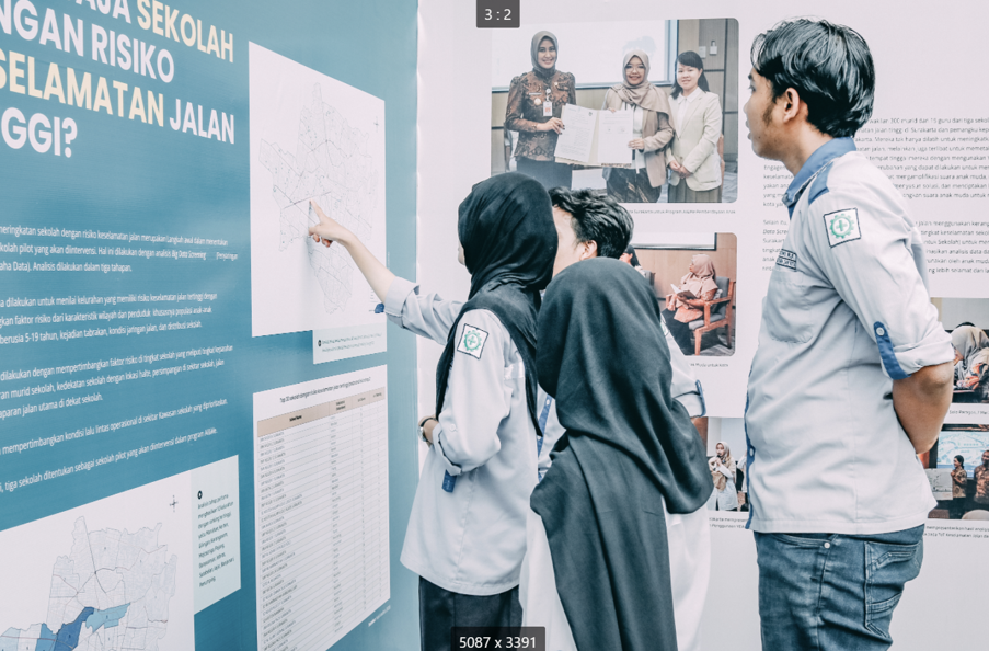
In Surakarta, the screening covered all 54 kelurahan and 145 schools, and highlighted ten school locations, attended by around 11,700 students, for closer assessment. These results now inform Classificação por estrelas para escolas (SR4S) assessments and recommendations developed with local partners.
Explore the interactive report
The full results are online in an interactive report built by Transportologi. Each level of the screening is a separate map layer:
Click a school or a row in the table to zoom to it and see the factors behind its ranking. Planners, schools and communities can all use it to start conversations about safer routes to school.
Scaling the approach across Indonesia
Surakarta shows that a city can build a clear, evidence-based picture of school road safety without surveying every street. Most of the inputs already exist in local and provincial government, and aggregated traffic data adds information on speed, one of the most important factors in how severe a crash is.
Transportologi adapted the methodology to the Indonesian context, working closely with the City of Surakarta and Central Java provincial agencies. Because it relies on data that are widely available, the same approach can be repeated in other Indonesian cities, giving local governments a shared, transparent starting point for prioritising detailed assessments and investment around schools.
“The Big Data Screening in Surakarta revealed the schools in Kelurahan Kerten and Manahan have highest road safety risks. This finding aligned with government concerns about the road safety situation in Surakarta, where the schools face higher risks due to a higher number of black spots and high traffic flow in these areas. This approach provides the government with better evidence in making decisions and directing road safety improvements in Surakarta.”— Sukma Larastiti, Director of Transportologi.
“The Big Data Screening methodology makes use of data that cities already hold, so that prioritisation decisions are based on evidence. By bringing together crash records, school and population data and real traffic speeds, Surakarta now has a clear picture of where children face the greatest risk and where investment will save the most lives.” — Shanna Lucchesi, Project Coordinator, International Road Assessment Programme (iRAP).
 Português do Brasil
 English
 Español de Colombia
 Français
 हिन्दी
